Stockholm Arlanda Airport (ARN)
Driving Directions / Travel by Car
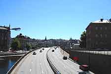
(Stockholm, Sweden)
The major E4 road runs the length of the city and links directly with the Stockholm Arlanda Airport (ARN). The E4 is signposted from all over Stockholm, allowing for easy navigation and access to the airport, passing Sollentuna, Upplands-Vasby, Hagangen, Rosersberg and Marsta along the way.
The airport is signposted locally as 'Stockholm-Arlanda Flygplats' and lies directly off the 273, Arlandavagen and Tvarvagen roads. Surrounding much of Stockholm Arlanda Airport is spreading countryside, together with a number of prominent lakes, such as Halmsjon to the east. Directly north, the villages and towns of Bergby, Balstaberg, Knivsta and Ostunaby can all be found.
Directions to Stockholm Arlanda Airport (ARN) from the north:
- Follow signs for the E4
- Join the E4 north to the airport
Directions to Stockholm Arlanda Airport (ARN) from the south:
- Follow signs for the E4
- Travel along the E4 north to the airport
Directions to Stockholm Arlanda Airport (ARN) from the east:
- Follow signs for the E4
- Take the E4 north, following signs to the airport
Directions to Stockholm Arlanda Airport (ARN) from the west:
- Follow signs for the E4
- Join the E4 north. Continue until you reach the airport
During busy times of the day, routes through to Stockholm Arlanda Airport can become congested and cause travel delays. We recommend that you allow extra travel time in your schedule for unforeseen hold-ups caused by adverse traffic conditions.
Stockholm Arlanda Airport (ARN): Virtual Google Maps
